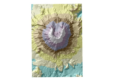
Figure 1. Digital Elevation Model depicting Mount St. Helens. Colors correspond to elevation.

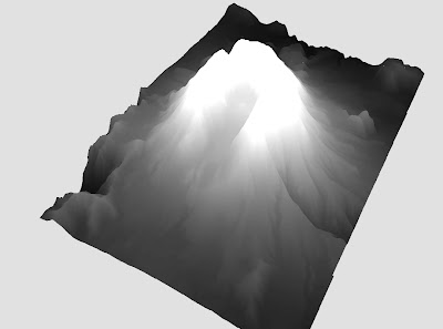
Figure 2. Three-dimensional Digital Elevation Model depicting Mount St. Helens. Continuous elevation shading.
 Figure 1.
 Figure 3. First Nation Reserves within 75 miles of Thurso, Quebec.
 Figure 1.
  Figure 2.
 Figure 3.

Figure 3.
Although none of the six projection’s Washington-to-Kabul measurement was correct, these inaccuracies may be due to coarse resolution of each map and the limitations of precision in the ArcMap measuring tool.
Table 1. Projection category, type of projection and measured distance in miles between Washington DC and Kabul, Afghanistan using six separate projections.
As a comparison, I measured the distance between Washington and Kabul using an old analog method. The tools required are a globe and a string. The measurement is simple as follows:
STEP 1. Stretch a length of string on the globe from Washington, DC to Kabul, Afghanistan as close as is practicable approximating the path along a great circle (Figure 4). 
STEP 2. Removing the string from the two points of the measurement, placing one end of the string at 0° lat, 0° lon, stretching it along the equator to obtain its length in degrees of longitude (Figure 5).
Figure 5.
STEP 3. Multiply the number of degrees measured by 69 miles.
For this operation, the distance the string stretched along the equator was approximately 100° of longitude. Multiplying 100 by the distance between 1° along a great circle (69 miles), the distance between Washington, DC and Kabul, Afghanistan is about 6900 miles (100 X 69 = 6900). This measurement is closer to the actual value between the two cities (6919 miles) than the measurement obtained from any of the projected maps, illustrating the dictum that the globe remains the truest representation of Earth.
ADDENDUM:
Of course, none of these provide the real method by which one would obtain the shortest distance to Kabul from Washington. For that there are these three steps:
(1) Have the CIA secretly train and arm thousands of Afghan fundamentalist jihadists (including Osama bin Laden) to defeat an occupying army of Russians during the 1980s.
(2) Allow the remnants of these jihadists to evolve into the ultra fundamentalist Taliban government during the 1990s.
(3) Feign surprise when these products of CIA training provide haven for terrorists with a deep abiding hatred for the products of U.S. foreign policy.
Follow these fool-proof steps and you’ll be in Kabul in no time.
Peace.
References
Alpha, Tau Rho and John P. Snyder 1982. The Properties and Uses of Selected Map Projections. Miscellaneous Investigations Map I-1402, United States Geological Survey. United States Government Printing Office, Washington, DC.
Birdseye, C. H. 1929. Formulas and Tables for the Construction of Polyconic Projections. Bulletin 809, United States Geological Survey. United States Government Printing Office, Washington, DC.
Christopherson, Robert W. 2006 Geosystems: An Introduction to Geography, Sixth Edition. Pearson/Prentice Hall, Upper Saddle River, New Jersey.
Committee on Map Projections, American Cartographic Association 1989 'Geographers and Cartographers Urge End to Popular Use of Rectangular Maps'. The American Cartographer. Vol 16, No. 3, pp. 222-223.
Greenhood, David 1964. Mapping. The University of Chicago Press, Chicago, IL
Merriam, G. & C. Co. 1969. Webster's Geographical Dictionary. G. & C. Mirriam Co., Springfield, MA
Robinson, Arthur H. 1960. Elements of Cartography, 2nd Edition. John Wiley and Sons, New York.
Snyder, John P. 1982. Map Projections Used by the U.S. Geological Survey. Bulletin 1532, United States Geological Survey. United States Government Printing Office, Washington, DC.
Snyder, John P. 1993. Flattening the Earth: Two Thousand Years of Map Projections. The University of Chicago Press, Chicago, IL
TRAVEL DISTANCE CALCULATOR BETWEEN CITIES www.mapcrow.info. Data retrieved 7 July 2010.